How Ressort Wonen commissions hybrid NEN2767 inspections to increase quality

&
"We should not see AI as a threat, but embrace it as a tool."
elk® group uses 3D real estate data from supRmen during renovation project
Customer
 elk® group
Branch
Maintenance
Location
Vlaardingen, Netherlands
Goal
Renovation
About
elk® group carries out renovation commissioned by Stadlander supported by 3D real estate data

The challenge

What opportunities are there for using 3D real estate data during a procurement process?

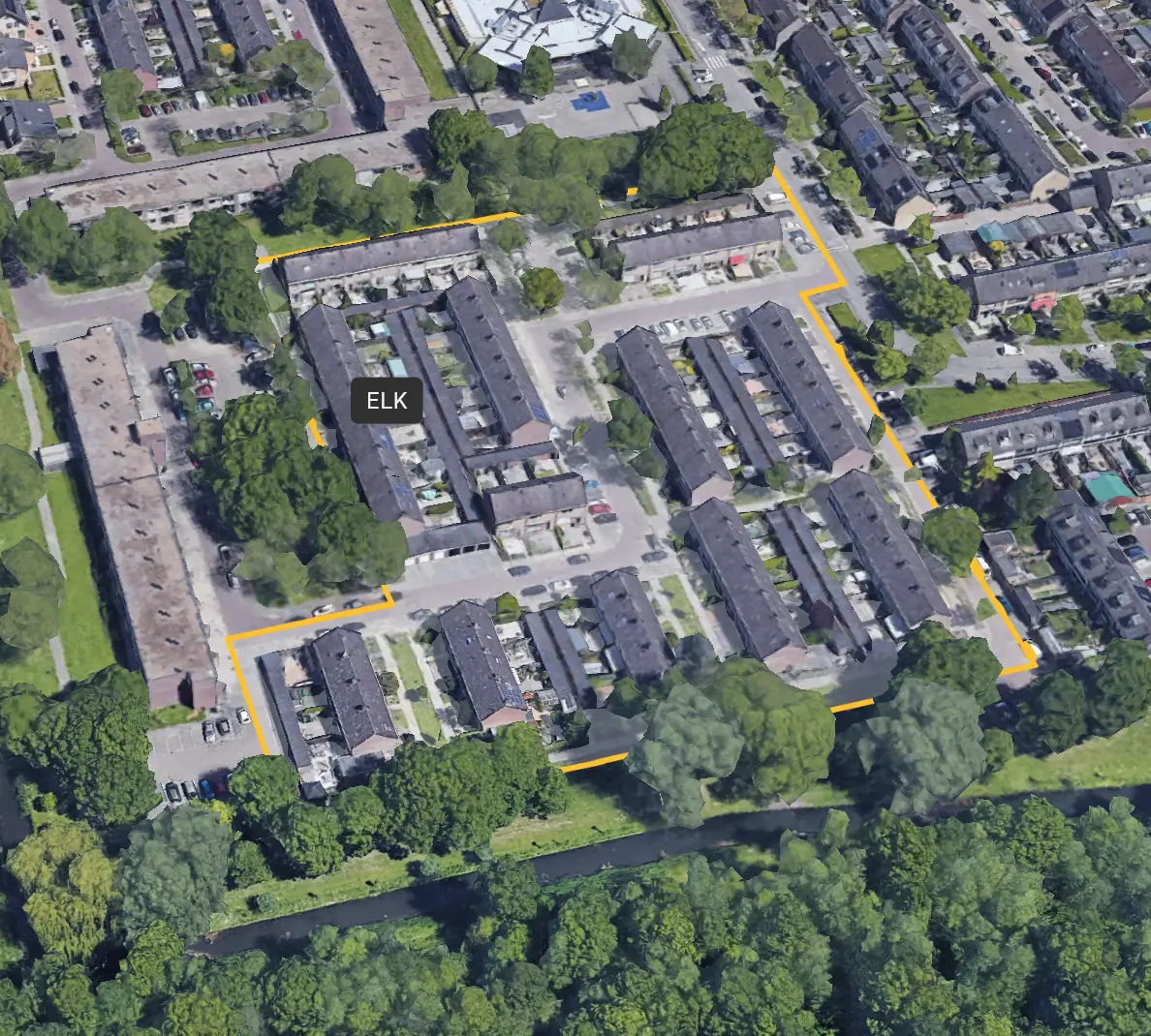
Each® group participated in a tender for the renovation project of 79 homes owned by Stadlander housing corporation on Hekelstraat, Schrankstraat and Zwingellaan in 's-Gravendeel (shaded green).

Wim Nieuwkerk of elk® saw opportunities for a collaboration with supRmen and BIMpartners for this project. The goal was to make the collection of all data needed to properly perform maintenance and renovation more efficient and complete using a combination of indoor and outdoor scanning technology.

elk® Group, BIM Partners and supRmen worked together to propose a solution to Stadlander. The key questions presented to supRmen for this purpose were as follows:

"What are the options and costs for:

  • Gathering extremely accurate property data from the roofs and facades;
  • Creating a photorealistic 3D model for a complete overview;
  • the ability to determine dimensions of frames, doors and other building elements in the model and detect damages and discrepancies."

Wim's idea paid off and elk® won the tender. The ongoing project aims to sustainably transform the homes for 25 years of worry-free use, including renovations to roofs, window frames and insulation, among other things.
The solution

Scanning the buildings with drones to quickly and accurately create a digital 3D model whose data is the starting point.

Our solution consisted of three phases:

  1. Gathering all images of the complex;
  2. Visualizing these images into a photorealistic 3D model;
  3. Quantifying numbers, dimensions and defects;

Gather

We started by informing all residents and neighbors within a 50-meter radius of the building through a comprehensive letter.

We then took about 1,200 photos of the complex. These photos were taken from the air by a drone as well as from street level with high resolution cameras. In this way the undersides of e.g. roof overhangs and gutters were captured from all angles with razor-sharp accuracy. The collection took only half a day. The images were taken with a measuring accuracy of 5 mm to enable accurate measurements - necessary for ordering new window frames, for example. In addition, the high resolution of the images (100MP) ensures that the condition can be determined.

In order not to invade privacy, individuals and license plates are automatically bulldozed by our algortime. This can be compared to Google Streetview.

Visualize

All photos taken by the drone and at the street level were stitched together into a complete online photorealistic 3D model in our cloud-based platform, in which all details were visible in 2D and 3D.

We collected all appointments, execution activities, documents and other information in a central place in our customer portal. This made all information centrally visible in one place and everyone was always up-to-date on the progress of the project.

Quantify

In this phase, all necessary data was extracted from the 3D model and converted to directly applicable information for each®, Stadlander and other stakeholders . The starting point was to determine quantities and dimensions. For this assignment, the choice was made to have BIMpartners determine the quantities and dimensions in their BIM models. Nevertheless, all salient damages were annotated in the 3D model so that elk® could act on them.

The result

During an interim evaluation with Wim, it appears that the 3D model adds value in several places in the process.

Calculation and preparation

elk® used the 3D model for planning and calculation, where accurate dimensions could be extracted from the model in no time. At the start of the project, the 3D model was used during the kick-off with all partners and subcontractors to visually include everyone in the project. This approach not only saved time, but also ensured seamless integration of the digital model into the practical implementation.

Implementation

The 3D model is also used during execution, serving as a tool during weekly progress meetings, among other things. The BIM and 3D model are consulted both for the technical definition of work and for solving practical issues, such as moving the central heating boiler and installing blinds. Based on the images, it is also possible to identify where incidental façade repair needs to take place and where, based on visible staining, cavity wall insulation might have subsided. This has led to considerable efficiency gains. Wim indicates that they "just saved a work week's worth of travel time" because employees did not have to drive to the site for every little thing.Benefits for subcontractorsIn addition to the benefits for each®, other stakeholders were also enthusiastic about this new way of working. Positive feedback was received from subcontractors, including the frame specialist, the roofer and the facade specialist. For example, the frame specialist was able to order the frames based on the BIM models created from the scans.

"We should not see it as a threat, but we should embrace it as a tool."
Wim Nieuwkerk
elk® group

The future

What will cooperation between elk® group and supRmen look like in the future?

Icon concerning insecurity

Future-oriented use of 3D models and supRmen platform

elk® Group is also betting on 3D models and specialized software for future projects. This eases the workload of estimators and offers promising opportunities to integrate this technology organization-wide, said Wim Nieuwkerk.

An arrow thrown into the dartboard

Positive embrace of AI as a tool

AI is seen by Wim and the team as a valuable tool, not a threat. Critical evaluation by colleagues is appreciated, but AI provides support for complex tasks within the field now and in the future.

An arrow thrown into the dartboard

Optimization of construction processes with AI

The integration of AI and imagery enables condition measurements and accurate monitoring of construction processes. Additional scans during and after execution, such as at completion, create objective baseline measurements that are valuable to end customers.

An arrow thrown into the dartboard

Comprehensive access to accurate information

The application of 3D models and AI results in detailed, high-quality images that provide valuable insights into even hard-to-reach areas. This reduces the number of resident visits and makes it easier to share data with clients and partners, enhancing collaboration and information sharing.

Easily save on inspection costs?

Get in touch and learn more about the savings and benefits our solutions offer.

"Want to know the financial benefits of accurate and complete real estate data? Calculate your cost savings."

Jasper Nederlof
Director - supRmen

Schedule free demo

Thank you! Your submission has been received!
Oops! Something went wrong while submitting the form.